
Hurricane Helene Timeline of Events
Tropical Storm – Monday, September 23
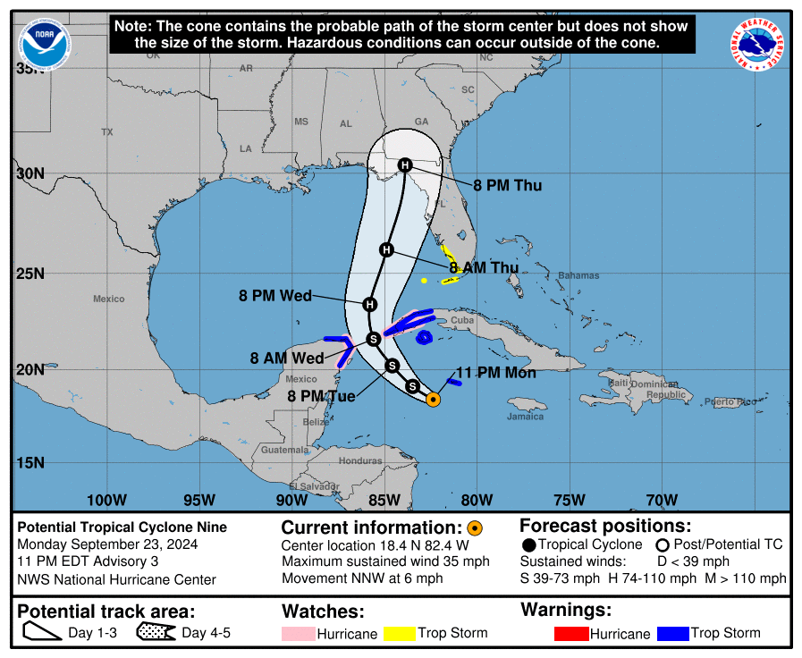
Forecasts throughout the day projected Helene to be a potential tropical cyclone. Helene was moving through the Caribbean Sea towards Cuba and the Yucatan Peninsula. Conditions were expected to upgrade to tropical storm conditions by Tuesday night. Heavy rains in portions of the Western Caribbean.
Hurricane Helene Update- Tuesday, September 24
Hurricane Helene forecasted to reach near hurricane strength upon reaching the Northwest Caribbean Sea. Hurricane-force winds expected for the Florida “big bend region”. Flash flooding and urban flooding projected across Florida and the southeast and south Appalachian regions.
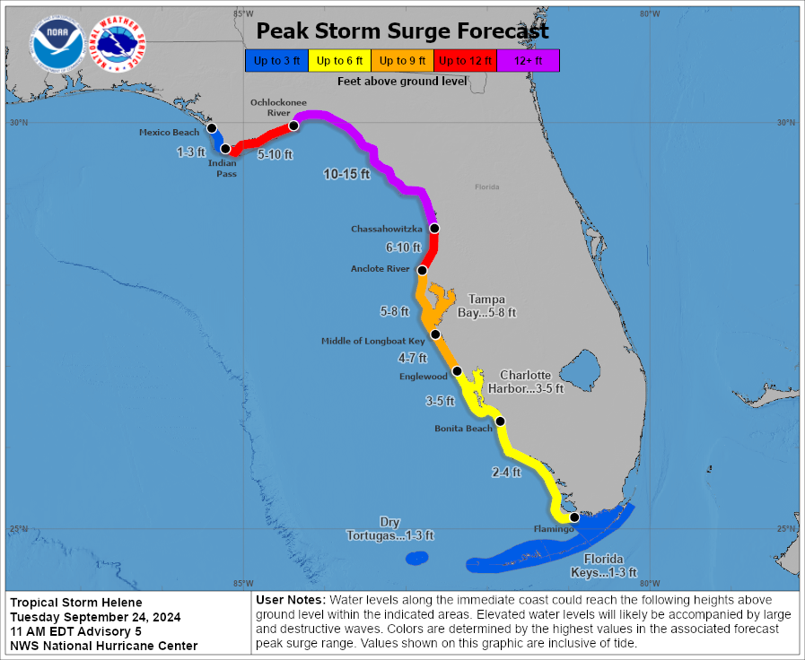
Hurricane Helene Update- Wednesday, September 25
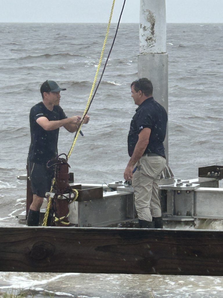
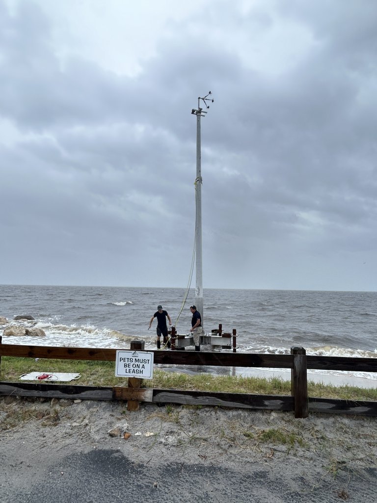
Catastrophic storm surge was likely to hit portions of the Florida “big bend” region and predicted to reach excess of 20ft above ground level with large waves. Potentially catastrophic hurricane-force winds were likely. Tropical storm conditions were projected for landfall in Cuba.
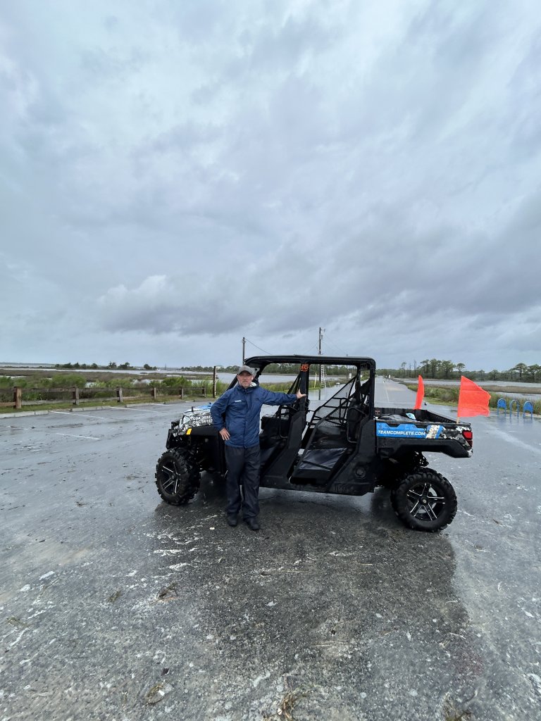
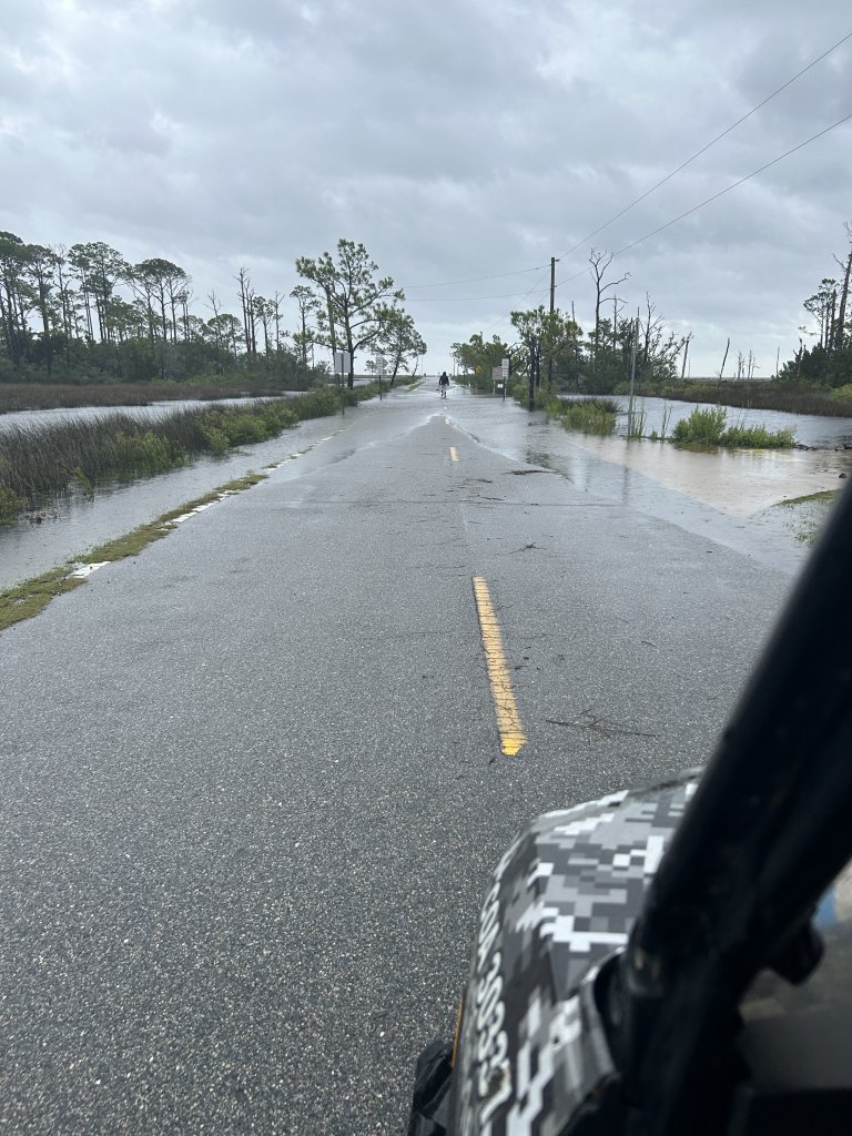
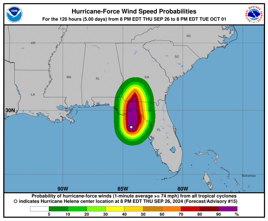
Hurricane Helene Update- Wednesday, September 26
Hurricane Ian landed near Cape Coral bringing dangerous storm surge and damage from Marco Island to the Fort Myers area.
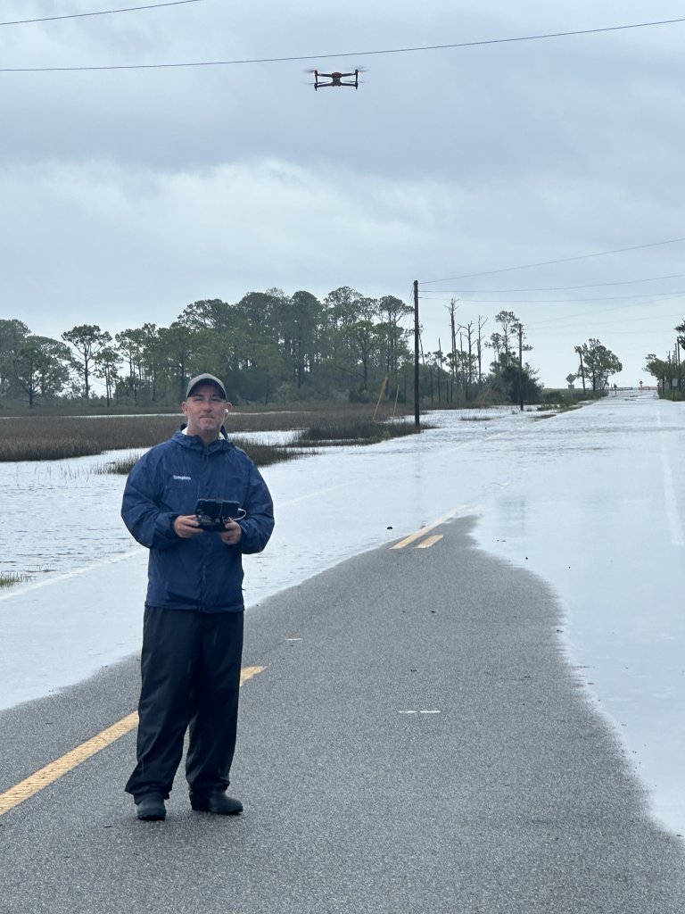

Hurricane Helene Update- Thursday, September 27
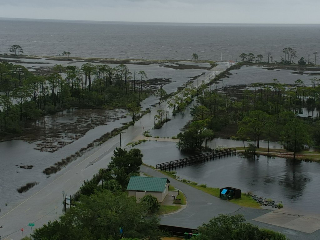
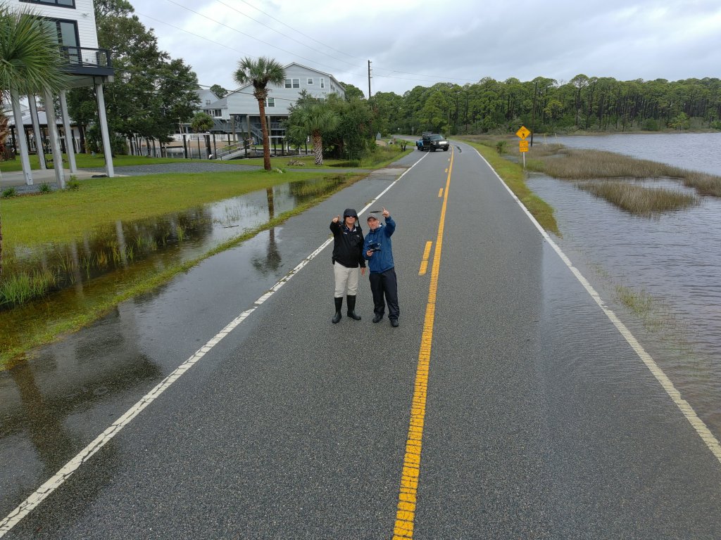
Hurricane Helene made landfall in Florida in the Tallahassee and Perry area.